
Dominica’s Journey to become the World’s First Climate Resilient Country


In Dominica, there was a scarcity of practical and comprehensive data which could be utilized for infrastructure planning and design. Additionally, there was the need to enhance institutional capabilities to effectively manage emergencies arising from disasters caused by natural hazards. The project was specifically created to tackle these needs, focusing on constructing resilient infrastructure that can withstand the impact of disasters and climate risks, as well as hazard data information systems to support decision making, risk reduction and emergency response. As the project enters its final year of implementation, the team takes a retrospective look at its successes and the positive impact on Dominica and its people.
1. Infrastructure and data systems for disaster risk management
Before the DVRP, Dominica’s hydromet monitoring capability was limited to two airports on the east and west coasts of the country which provided minimal information about the spatial distribution and variability of rainfall and water flows. Under the DVRP, the hydromet network was expanded to 44 automatic weather stations, rain gauges, and water level sensors covering all areas of the island. This extensive coverage now allowed for the recording of localized heavy rainfall events, a common occurrence in Dominica. During a trough system in November 2022, the new network detected that 500mm of rain fell in the Southeast over a two-day period. These instruments continued to transmit data on the impact of the storm. captured the degree of storm surge experienced on the coasts, and allow for real-time tracking of hydrometeorological systems and seismic events to inform disaster preparedness and other planning
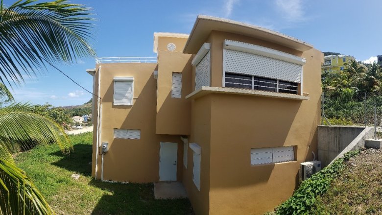
The receiver and processor for the incoming data is the Dominica Meteorological Services (DMS) headquarter building, also constructed under the DVRP. The DMS has responsibility for weather forecasting and other meteorological services which require a well-equipped office building with advanced instrumentation and communications equipment to transmit rainfall and seismic date to early warning systems and other uses. With a concrete roof, a backup power system, and windows outfitted with hurricane shutters, the building was designed to withstand both major earthquakes and category 5 hurricanes. Furthermore, it has amenities for 24-hour weather monitoring and subsequent operation of the emergency response center.
The seismic monitoring network, operated by the University of the West Indies Seismic Research Center (UWI-SRC), which detects seismic activity across Dominica, was damaged and inoperable after Hurricane Maria. Equipment purchased under the DVRP restored the monitoring network, and advances in connectivity and contingency planning ensure its sustainability and resilience to weather events. Dominica is one of the most seismically and volcanically active islands in the Caribbean, and having continuously operable monitoring systems is critical to disaster preparedness planning initiatives.
The DVRP also funded critical geospatial data collection, including aerial mapping using LiDAR for topography and bathymetry, high-resolution cameras for red/green/blue (RGB) and infrared imagery, and a national soil survey. These investments have greatly improved the ability to accurately assess the exposure of population and infrastructure to hazards. This data will be housed within another DVRP investment Dominode, the country’s Geographic Information System (GIS) repository. Outputs have, for example, been used to create detailed hydraulic models for the design of bridges.
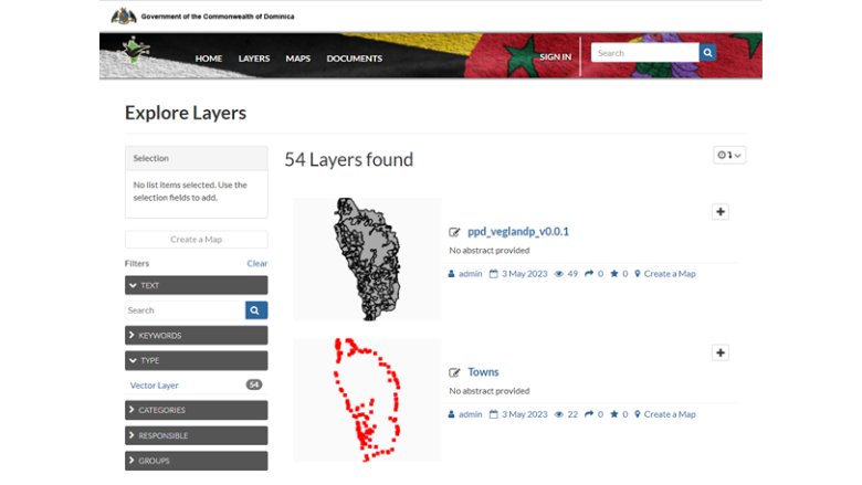
Dominica is also preparing enabling legislation for data sharing and data privacy through Dominica’s Climate Resilient Executing Agency of Dominica (CREAD) and facilitating the creation of a Geographic Information Systems (GIS) Unit. Dissemination of hydromet data was also improved with the creation of a portal which allows access to data collected by the new network on a nearly real-time basis. Integration of these datasets has proven valuable for the design of resilient infrastructure and the improvement of early warning and emergency response systems. There is untapped potential for environmental models to assist in spatial planning and risk management. Integration of the hydromet data with international climate models can also increase the understanding of the dynamics of climate change in the Eastern Caribbean.
The complementary activities have enhanced Dominica’s data collection, coordination and management for disaster management and risk reduction.
2. Ensuring continuous access to water throughout the island
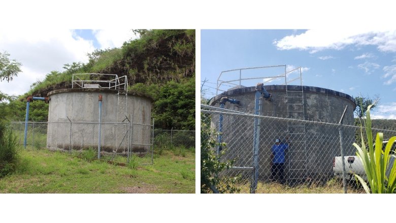
In 2020, eight water tanks along the western coast of the island were constructed serving 20 communities and 11,000 direct beneficiaries, or 15 percent of the national population, and increasing water storage capacity by over 1 million liters. Following Hurricane Maria, sections of the new water distribution system and its access roads were upgraded using improved construction techniques and material to augment their resilience to recurring disasters. Access to clean water was challenging after Hurricane Maria, and these investments ensure that water supply will not be interrupted in recovery efforts or droughts.
3. Strengthened efforts for building nature-based solutions (NBS) and forest conservation.
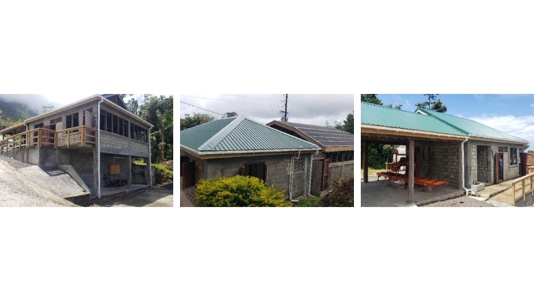
Dominica is known as “the Nature Island” and is globally renowned for its lush forests, a main attraction for nature tourists. However, Dominica’s beautiful, mountainous, and rugged landscape also creates significant engineering challenges in reducing infrastructure vulnerability to disasters and climate change. The landscape is prone to landslides, and during a significant rainfall event in November 2022, 11 large landslides impact transportation networks and communities. The DVRP is incorporating NBS along the East Coast Road (ECR) in Dominica in the ongoing construction of resilient infrastructure. The project is partnering with the Ministry of Agriculture’s Forestry Division to cultivate and maintain native plants that can complement other hard infrastructure interventions for slope stabilization. This activity builds upon the forestry nursery facilities which also were expanded under the DVRP to improve the nursery capacities of the Forestry, Wildlife and Parks Division for the propagation and evaluation of planting stock for forestry uses. Improvements included rehabilitation of existing support infrastructure including buildings, planting sheds, irrigation, storage sheds and related infrastructure.
4. Improved access to indigenous populations for more resilient economies.
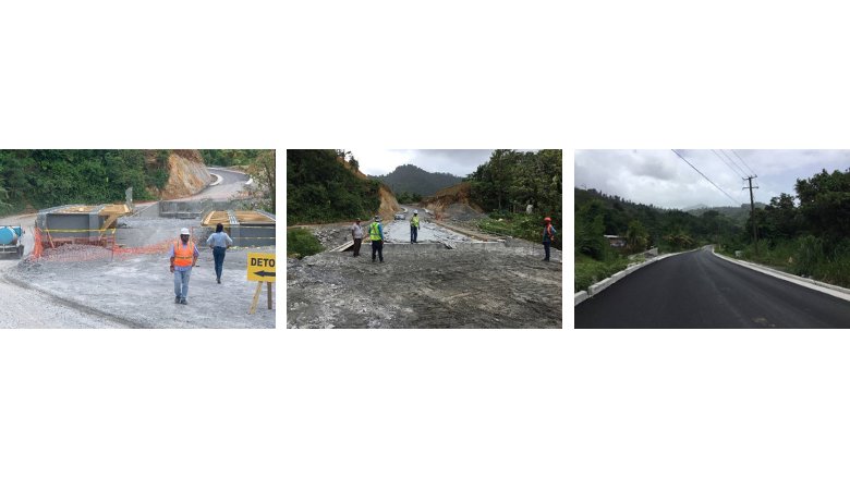
The DVRP is widening and refurbishing 31 km of the ECR with a goal of increasing resilience to extreme weather events and improving connectivity. Rehabilitation efforts entail substantial slope and landslide stabilization, flood mitigation activities along the entire corridor, bridge protection and replacement, expansion of road width, and mitigation of river erosion along the road embankments. In total, 5 bridges, 77 culverts, 22 retaining walls and 607 m of new drains are under construction. This road is important to Dominica’s physical and socio-economic resilience because it provides an alternate route to the airport, access to tourist sites, and transportation routes for agricultural products and the indigenous Kalinago tribe. ECR serves as a key vehicle for the government’s response to the many severe weather events which have occurred over the last several years.
5. Improved human capital
An essential component in resilience is enhanced local capacity to assess the country’s hazard exposure and make data-informed decisions toward risk mitigation. In this regard, the DVRP has supported training of government staff and private sector professional associations to ensure the sustainability and use of its investments in risk reduction. One of the key ways in which these investments have assisted in response and recovery efforts is through a training on tracking real time flood information to inform future transportation infrastructure investments. This training activity collected flood high-water marks in affected communities, which, combined with radar data, were used to determine island-wide rainfall total estimates as well as peak discharge and water levels. The results of these investigations were published in the Journal of Hydrology in 2016 and have been used in the design of new bridges and other hydraulic structures post-Tropical Storm Erika, including the ECR and new bridges in Roseau.
Additionally, the DVRP has supported the purchase of surveying equipment and software, and training on its use, for the Technical Services Division of the Ministry of Public Works. This equipment, which included high-accuracy laser scanners, allowed engineers and surveyors to quickly map areas impacted by storms and design bypasses, retention walls, and other structures necessary for the reopening of transportation corridors. As the project comes to a close, further training is planned for the DMS to increase capacity in maintenance and use of recently purchased hydromet instrumentation.
Conclusion
Crédito: Link de origem

- Advertisement -
Comentários estão fechados.